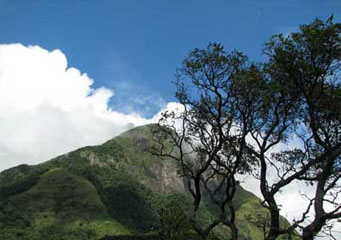
Above: Knuckles Clouds
- Home
- Types of Clouds
- Accessory Clouds
- Altocumulus Castellanus Clouds
- Altocumulus Clouds
- Altostratus Clouds
- Anvil Clouds
- Anvil Dome Clouds
- Anvil Rollover Clouds
- Arcus Clouds
- Backsheared Anvil Clouds
- Cirrocumulus Clouds
- Cirrostratus Clouds
- Cirrus Clouds
- Clear Slot Clouds
- Cloud Tags Clouds
- Collar Clouds
- Condensation Funnel Clouds
- Congestus Clouds
- Cumulogenitus Clouds
- Cumulonimbogenitus Clouds
- Cumulonimbus Clouds
- Cumulus Clouds
- Debris Clouds
- Dry Slot Clouds
- Duplicatus Clouds
- Fallstreak Hole Clouds
- Funnel Clouds
- Hail Fog Clouds
- Hot Tower Clouds
- Incus Clouds
- Inflow Band Clouds
- Intortus Clouds
- Inverted Cumulus Clouds
- Knuckles Clouds
- Lacunosus Clouds
- Mammatus Clouds
- Nacreous Clouds
- Nimbostratus Clouds
- Noctilucent Clouds
- Opacus Clouds
- Pannus Clouds
- Perlucidus Clouds
- Pileus Clouds
- Praecipitatio Clouds
- Pyrocumulus Clouds
- Radiatus Clouds
- Roll Clouds
- Rope Clouds
- Scud Clouds
- Shelf Clouds
- Species Fractus Clouds
- Stratocumulus Clouds
- Stratus Clouds
- Striations Clouds
- Tail Clouds
- Towering Cumulus Clouds
- Translucidus Clouds
- Tuba Clouds
- Undulatus Clouds
- Velum Clouds
- Vertebratus Clouds
- Wall Clouds
Knuckles Clouds
You have probably seen knuckles clouds in the sky and wondered what they mean. What does this cloud formation say about the weather? Is a thunderstorm or a tornado about to occur? These are only some questions that might bother you upon seeing this seemingly threatening cloud form. Read further to learn more.
As the name suggests, knuckles clouds are clouds that exhibit a knuckle-like pattern in the sky. The term is the informal variation used by the World Meteorological Organization for the supplementary cloud feature, mammatus which has distinctive lumpy projections hanging beneath an anvil. Many people believe that these clouds signify upcoming severe thunderstorm. However, knuckles clouds more often indicate that a severe thunderstorm is weakening or has already passed and a tornado is not developing. It can be found in different cloud types but the most stirring manifestation of knuckles clouds is under the base of an anvil cloud spreading on the summit of a gigantic cumulonimbus cloud.
How do Knuckles Clouds look Like?
Knuckles clouds appear as dark or semi-transparent sagging pouches with smooth or worn out characteristics extending beneath the anvil cloud. The individual globular lobes have an average diameter of 1 to 3 kilometers and 0.5 kilometer in length. These clouds could be organized in a secluded or field of similarly-sized or irregular globular lobes scattered all over the sky. Knuckles clouds may last for 10 minutes to several hours.
At What Height is Knuckles Clouds Found?
The heights at which knuckles clouds can be found differ according to the atmospheric temperature. However, these clouds often appear below anvil clouds at elevations above 30,000 feet from the Earth’s surface. Knuckles can be composed of water droplets, ice crystals or both. Aviation enthusiasts take note and avoid knuckles clouds due to the intense wind shear occurring in the cumulonimbus cloud. Even though they appear under an anvil cloud that indicates extreme weather condition, knuckles clouds often appear in a weakening thunderstorm.
How are Knuckles Clouds Formed?
Knuckles clouds form due to the reversal of natural convective process. In normal convection, warm and moist air rises due to surface heating and condenses to form clouds. As warm air continues to rise onto the troposphere, air and temperature stabilize causing the rising warm air to expand horizontally creating an anvil cloud. This horizontal expansion causes atmospheric instability under the anvil and continues to grow downward creating nearly symmetrical lumps that may cover large areas.
Classification of Knuckles Clouds
Knuckles clouds can be found in different cloud genera such as stratocumulus, altostratus, altocumulus, cirrus, and cumulonimbus clouds.
How common are Knuckles Clouds
Knuckles clouds are common across the United States, perhaps in the middle and eastern states especially during warm months. These clouds often develop in the mid-afternoon to early evening due to intense ground heating and convective activity which makes the atmosphere favorable for thunderstorm formation. Knuckle cloud is often visible after a tornado.
Knuckles clouds do not signify an upcoming tornado. Even though they sometimes develop on the backside of an anvil cloud which indicates severe thunderstorm, their occurrence often points out that the thunderstorm is weakening. Even so, knuckles clouds come with strong bursts of wind, sometimes dropping huge hail.
