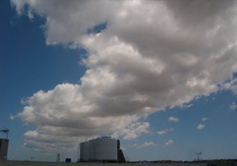
Above: Cumulus Tuba
Cumulus Tuba
Although the cumulus clouds are usually associated with fine weather, as they only form in the morning and after a summer storm late in the afternoon, they can be responsible for heavy rains due to winds. Since these clouds tend to develop upright, sometimes the cumulus mediocris reaches the cold fronts of air in the troposphere and hence transform into cumulus congestus clouds. The congestus clouds are very rarely the result of convection alone and in order to form, they need atmospheric instability. In case heavy winds are also present in the troposphere, it provides all the conditions that are set for the materialization of the cumulus tuba clouds.
What are cumulus tuba clouds?
Dissimilar to other types of cumulus clouds, which seem to have a flat darker shade at the base, the tuba clouds have their inferior part shaped in the form of a tuba or tornado. Because they tend to materialize under the lower altitude rain clouds, they are often an indicator of heavy rain and high speed winds. Therefore, if you were to notice a rounded cloud formation that seems to be falling down on the ground in a thin line, that is a clear indicator of a tuba cloud.
How are cumulus tuba clouds formed?
In order for the tuba clouds to occur, the following weather conditions must be present: heavy wind and at least one mass of hot air that is being carried in the upper parts of the atmosphere. The blend between the cold air that can be found in the lower parts of the troposphere and the hot air that is conducted in all directions by wind will sometimes cause a rotation of the water vapors on a horizontal axis. However, in order for the base to take the shape of a funnel, the winds need to redirect the heavier areas vertically.
What height are cumulus tuba clouds found?
Because the tuba clouds are mostly forming under the cumulus congestus clouds, that implies that they usually form at anywhere between two thousand and twenty thousand feet above sea level. Even though their altitude often varies according to the amount of humidity found in the air, it is important to note that not all tuba clouds will become tornados, especially the ones forming at over ten thousand feet altitude. However, if the winds are heavy, in unstable weather conditions they can create cyclones.
How common are cumulus tuba clouds?
Since they need unstable weather conditions and heavy currents in order to take their cone shape as well as fronts of warm air, they are most common for spring and autumn. On the other hand, considering that global warming has created some disturbances in the traditional climates and seasons, there is a chance they materialize in summer as well. Even though the conditions that lead to the development of the cumulus congestus clouds can be found in most parts of the globe, the tuba clouds can often be observed in the following regions:
- Pacific Coast of the United States
- Central America
- Pacific Coast of Japan
