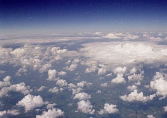
Above: Cumulus Mediocris
Cumulus Mediocris
In order to understand more about how meteorologists predict the weather, you should learn more about the messages the clouds carry regarding the future forecast. Even though they differentiate the clouds into three distinctive families, meteorologists also include other details in the clouds' names to ensure that the forecast is as accurate as possible. For instance, the cumulus mediocris refers to a cloud formation, part of the cumulus family and can usually be found at a lower to medium level height in the atmosphere.
How do cumulus mediocris clouds look like?
Because they are part of the cumulus category, you can recognize these clouds as the inflated formations of white with different shades of grey. Even though they sometimes include shades of grey, there are few chances that these clouds will bring precipitations. The puffy appearance of these clouds can be explained by the fact that they are as big upright as they are wide. While their vertical height cannot be correctly appreciated by a ground observer, most people will recognize them as the clouds with an even looking base.
What height are the cumulus mediocris clouds found?
The mediocris clouds can usually be found around two thousand to four thousand feet high in the troposphere. However, since the altitude variation depends on the amount of humidity that can be found in the air, they can also be located at fifteen hundred and ten thousand feet high in the atmosphere. It is important to note that these clouds are considered the link between the water vapor saturated lower clouds and the ones found at very high altitudes.
How common are cumulus mediocris clouds?
Since they are very common for warm climates and season, they are mostly formed due to convection. Consequentially, during the day these clouds will be noticed in the morning and in the afternoon. However, in windy areas they seem to break up in smaller formations, a variation of the mediocris clouds known as fractus. The other adaptations from the cumulus mediocris that can form according to the weather conditions include:
- Cumulus congestus
- Cumulus praecipitatio
- Pilleus
- Panus
- Velum
- Radiates
- Orographic
- Arcus
- Cumulus humilis
How are the cumulus mediocris clouds formed?
Similar to most clouds, the mediocris clouds form due to warm air rising, a process known as convection. Overall, in order for them to form they need large areas that emanate hot air which rises in the atmosphere in a shape of a bubble. As the hot bubbles of air lift up higher and higher in the atmosphere, they will start to cool down gradually at a rate of about ten degrees per kilometer of ascent. On a side note, these clouds can transform into cumulus congestus only when there is enough moisture in the air. Therefore, this phenomenon is not very common in deserts or arid areas of the globe.
Where can I see cumulus mediocris clouds?
Usually, these clouds appear in any region of the world, they form anywhere they can find the right aforementioned weather conditions. The only area that does not have enough warm air to promote these clouds formation is the South Pole.
